Where is action needed?
Climate change will impact all parts of the UK in some way during our lifetimes and everyone in our society will feel the effects at some point
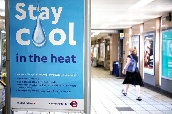
Overheating on the London Underground is already a public health risk in today's climate © Environment Agency
Whether it is impacts on homes, workplaces, transport, livelihoods or holiday destinations, all individuals, communities or locations will be affected. The type and extent of adaption needed will vary depending on the type and severity of likely climate change impacts and the vulnerability of those affected. The most vulnerable communities are those most likely to be impacted by specific climate effects and also those least able to protect themselves, whether on financial, physical or social grounds. This adds to the case for climate change adaptation action to be integrated within all services.
Though future climate change predictions for the UK show variations, many areas will experience similar changes, such as increases in summer temperatures, increases in winter rainfall and increased instances of extreme weather. However, some impacts will be felt more severely in particular areas, for instance:
- Areas exposed to flooding from rivers or from surface water flooding
- Areas along the coast where coastal erosion, sea level rise and flooding may be an issue
- Built-up urban areas which experience the ‘Urban Heat Island’ effect and
- Remote rural and coastal areas which are more likely to become isolated.
Likewise, there are certain community characteristics which will intensify the effects of climate change, for instance:
- Where there are higher proportions of young children and babies
- Areas with concentrations of older people or those living with disabilities or physical illnesses.
Previous research undertaken for the JRF reveals a distinct North-South divide in terms of socio-spatial climate vulnerability in England. The North West and the Yorkshire and the Humber regions have the highest proportions of neighbourhoods which are extremely socially vulnerable to river flooding. Average (mean) social-spatial flood vulnerability is lowest in the East of England and South East. This North-South divide also exists for socio-spatial vulnerability to heat, if London is discounted. However, temperatures tend to be higher in the South, so leading to less of a coincidence between vulnerability and exposure to heat.
These patterns still hold in updated, finer-scale work on flood vulnerability and disadvantage completed in 20171. However, the updated data provide further insights. Furthermore, social vulnerability and disadvantage are analysed in relation to investment in flood defences and development in floodplains. Findings are reported for urban and rural areas and other useful geographical units, such as ‘cities in decline’. Findings are also given for future trends, including considering the impacts of climate change. See the map tool to identify the vulnerability and disadvantage in your local area.
The actual actions that need to be taken will be contextually specific. Adaptation planning and action will vary between local areas because of the differing impacts these predictions will have on communities within the area, and the characteristics of these communities.
References
- Sayers, P.B., Horritt, M., Penning Rowsell, E., and Fieth, J. (2017). Present and future flood vulnerability, risk and disadvantage: A UK scale assessment. A report for the Joseph Rowntree Foundation published by Sayers and Partners LLP

Built by:
![]()
© 2014 - Climate Just
Contact us